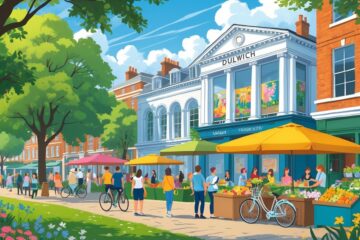
Tucked away in South London, Dulwich stands out for hosting London’s last functioning tollgate. This isn’t just a quirky relic—it’s a living link to over a thousand years of British history.
The area has seen it all, from Saxon kings granting land charters to Victorian toll collectors waving through horse-drawn carriages. There’s an unbroken thread of history here that you can still feel in the air.
Dulwich’s story kicks off in 967AD, when King Edgar handed this “meadow where the dill grew” to one of his nobles. That simple act set Dulwich on a wild journey through medieval monasteries, Tudor landlords, and Georgian entrepreneurs.
The Dulwich toll road has been running since 1789. It’s not just a curiosity—it’s a living, breathing symbol of how this area has evolved from a rural hamlet to one of London’s most prestigious neighborhoods.
From the founding of Dulwich College to the quirky survival of Britain’s last tollgate, Dulwich somehow manages to keep its unique character intact. The tollgate’s story starts with John Morgan, Lord of the Manor of Penge, who built the road in 1789 just to connect his fields—a practical move he probably never imagined would become a historical oddity.
Key Takeaways
- Dulwich’s written history goes back over 1,050 years to a royal charter from King Edgar in 967AD.
- London’s last tollgate has been charging drivers since 1789 and still operates today for £1.20 per trip.
- The area grew from a medieval hamlet of 100 people into a top-tier estate, all while keeping its historic charm.
The Origins of Dulwich and Early Development
Dulwich started out as a Saxon hamlet called Dilwihs in the 5th century, which means “the meadow where the dill grew.” King Edgar’s royal grant in 967 AD gave us the first real record of the place, setting boundaries that would stick for centuries.
From King Edgar’s Grant to Medieval Ownership
King Edgar granted Dulwich to one of his thanes in 967 AD, making it official. The name popped up in all sorts of spellings—Dylways, Dullag, Dilwysshe—over the years.
The manor’s borders followed natural landmarks you can still spot today. Sydenham Hill marks the south, Denmark Hill the north, the River Effra to the west, and Lordship Lane to the east.
Key ownership changes:
- 967-1127: Royal thanes
- 1127-1544: Bermondsey Abbey took over after Henry I’s bequest
- 1544-1586: Henry VIII dissolved the monastery and sold it to Thomas Calton
- 1586-1605: Francis Calton inherited the estate
The monastery enjoyed the land’s income for 400 years until Henry VIII’s reforms flipped everything upside down.
Growth of Dulwich Village and Early Estates
The original hamlet is still visible in the broad high street, now Dulwich Village. This spot has always been the heart of settlement, shaping Dulwich even now.
Fields, farms, woods, and common land once wrapped around the village center. Dill might have even been grown here for Roman Londinium’s markets, just five miles away—who knows, right?
Francis Calton became Lord Mayor of London and got knighted in 1605, but his luck didn’t last. Bad investments forced him to sell Dulwich Manor to Edward Alleyn that same year.
The early estate included:
- A central hamlet with a broad high street
- Farmland and open fields
- Wooded areas
- Commons for grazing
- Handy access to London markets
Calton Avenue today is named after Thomas Calton, the goldsmith who once owned the whole manor.
College Road and the Establishment of the Tollgate
In 1787, John Morgan built a private road through Dulwich Woods to reach his rented fields on Penge Common. That road, now College Road, would soon host the Dulwich tollgate, established in 1789.
Building of College Road and Its Importance
John Morgan, Lord of the Manor of Penge, needed a better way to move his cattle and carts between his fields. So, he pitched the idea of “Locus Lane” to the local college in 1787.
The new road would shave 1 mile 8 poles off the trip from Penge to Dulwich high road via the Common. Not bad for the 18th century.
The college agreed, but with strings attached:
- Road width: No more than 30 feet
- Tree removal: Morgan paid for any trees he took out
- Annual rent: Two shillings a year for the privilege
By August 1787, the road was already a local sensation. College records even said, “The Road down Locus Lane is now the Admiration of the County.”
Morgan’s road soon connected his fields to Penge Common, which eventually became the site of the Crystal Palace. That link turned out to be a big deal for local travel.
Creation of the Dulwich Tollgate in 1789
Morgan put up the first toll gate cottage in 1789 to protect his new road. A college note from that year talks about “the erection of a cottage for a Person to look after the intended Road” since Morgan was “every day suffering some injury to his locks.”
At first, Morgan could only charge tolls to people going through his rented fields. This right came straight from his lease with the college.
Things shifted in 1802 when Morgan handed the lease to John Scott of Penge. After the lease ended in 1809, the college kept the toll-keeper, Mrs Clarke, paying her three shillings a week.
Early toll charges:
- 3d per car for a return journey
- 3d per horse, mule, or donkey pulling a cart
- 2d for animals not pulling carts
- 10d for cattle per score
- 2½d for sheep, lambs, or hogs per score
These days, the Dulwich Estate still runs the toll, charging £1.20 for each trip down the 1.5-kilometre College Road.
A Closer Look at the Dulwich Tollgate
The Dulwich tollgate now runs from a modern kiosk, which replaced the old Victorian booth. The Grade II listed keeper’s cottage next door dates back to about 1821.
Current fees are £1.20 per vehicle, and the gate’s open every day except Christmas.
The Tollgate Booth and Keeper’s Cottage
The original booth is long gone, swapped for a modern, safety-compliant kiosk. In January 1993, the Health and Safety Executive stepped in and required a new gate-keeper’s kiosk to replace the old Victorian booth.
The keeper’s cottage is a different story. Built around 1821, this Grade II listed spot sits right next to the kiosk on College Road. Toll collectors used to live here, keeping an eye on things.
John Morgan built the first cottage in 1789 when he put in the road. It was tiny—just 16 by 12 feet—and sat close to the gate for convenience.
The current cottage replaced Morgan’s original in the early 1800s. The Dulwich Estate has even advertised it as a private home, but it still feels like part of the tollgate’s DNA.
Historic and Modern Toll Fees
Toll charges have changed a lot since 1789. Back then, it was all about horses and livestock, not cars.
Historic charges:
- 3d per horse pulling a cart
- 2d per horse not pulling
- 10d for cattle per score (20 animals)
- 2½d for sheep or pigs per score
Cyclists once paid 2d, but that ended in 1897 after too many arguments. A photographer even caught a spat between a cyclist and the toll keeper, which finally convinced the governors to scrap the fee.
Motor cars showed up in the early 1900s, with a 3d charge per return trip. By 1993, it was 50p, and now you’ll pay £1.20 for a single journey.
The tollgate went fully cashless in April 2024, dragging this 18th-century system into the modern era.
Hours of Operation and Holiday Exemptions
The Dulwich tollgate runs seven days a week, all year long. But on Christmas Day, the gate’s free—just once a year.
That’s the only time you can cruise down College Road without coughing up £1.20. The Christmas tradition keeps a bit of old-school spirit alive.
Operating hours fit daily commuters and weekend visitors to the Dulwich Estate. The cashless system means you don’t need someone at the booth around the clock.
For the 200th anniversary in October 1989, they brought in sheep from Kent and horse-drawn carriages. People dressed up in period costumes and collected tolls the old-fashioned way—just for the fun of it.
The Role of the Tollgate in Dulwich’s Community
The Dulwich toll has a real impact on daily life, controlling traffic along the busy South Circular Road. This odd little system helps keep Dulwich Village peaceful—something you notice as soon as you arrive.
Traffic Management and Environmental Impact
The tollgate works as a natural filter on College Road, stopping it from turning into a noisy shortcut. You’ll see far fewer cars here than on other roads leading to the South Circular.
That drop in traffic actually makes a difference. Fewer cars mean less pollution and quieter streets for everyone nearby.
The £1.20 fee is just enough to make people think twice about using this route. Most drivers pick another way, so traffic stays manageable.
The tollgate’s spot between Fountain Drive and the South Circular creates a buffer. It shields the quieter residential streets from heavy traffic.
Cleaner air is one of the perks. With less traffic, Dulwich’s green spaces and family homes get to breathe a little easier.
Preserving Tranquillity in Dulwich Village
The toll system really acts as a guardian of Dulwich Village’s peaceful atmosphere. You can walk through streets that stay relatively quiet, even though they’re close to major South London transport routes.
Property values in the area tend to benefit from this calm environment. The tollgate helps keep the village-like character that draws in people who want a quieter lifestyle within London.
Cyclists and pedestrians experience safer conditions because there’s less traffic. The quieter roads make it nicer for families with kids and for elderly residents to get around the neighbourhood.
London’s last remaining tollgate manages to preserve a sense of historical continuity while serving today’s community needs. This mix of heritage and practicality makes Dulwich stand out among South London areas.
The toll barrier stops the area from turning into a rat-run for commuters. That protection helps Dulwich Village keep its distinct identity as a real residential community, not just another traffic corridor.
Surroundings: Connections and Neighbourhoods
Dulwich sits in a spot that connects it to major transport routes through the South Circular Road. Fountain Drive offers scenic access to the Sydenham Hill ridge, which marks the area’s southern edge.
South Circular Road and Access
The South Circular Road runs along Dulwich’s northern edge, giving you important connections to central London and nearby boroughs. It’s a major route linking Dulwich to places like Wandsworth, Clapham, and Greenwich.
You’ll notice the road carries a lot of traffic between South London districts. It has shaped Dulwich’s development since the early 20th century.
Because the South Circular is so close, you can easily reach other parts of London by car or bus. Several bus routes use this road to link Dulwich residents to key spots across the city.
At the same time, the road creates a natural boundary between Dulwich and its northern neighbours. This separation has helped Dulwich keep its unique character while staying accessible.
Fountain Drive and Sydenham Hill
Fountain Drive is one of the most scenic ways to approach Dulwich from the south. The tree-lined road climbs up towards Sydenham Hill, and you can catch glimpses of Victorian and Edwardian architecture along the way.
Sydenham Hill forms Dulwich’s natural southern boundary, creating an elevated ridge that’s defined the manor’s limits for over a thousand years. The hill gives you sweeping views across South London.
Fountain Drive connects to the historic Cox’s Walk. This path was cut through the woods in 1704 by John Cox to attract customers to his Green Man tavern.
The hill’s wooded areas have mostly stayed intact. They offer peaceful walking routes and keep that green character that sets Dulwich apart from its more urban neighbours.
Legacy and Modern Life on the Dulwich Estate
The Dulwich Estate still operates as a registered charity nearly 400 years after Edward Alleyn’s founding vision. These days, the estate balances historical preservation with modern housing needs and maintains a lot of green space across 1,500 acres of South London.
Dulwich Estate’s Ongoing Role and Management
The Dulwich Estate today manages around 1,500 acres as a registered charity. The organisation comes directly from Edward Alleyn’s 17th-century foundation.
The estate’s management structure has changed a lot over the years. Modern estate administration keeps the main role of trustees for the various charitable purposes Alleyn set up.
Current Estate Features:
- Gardens and parks
- Allotments and woodland areas
- Golf club facilities
- Residential properties
- Commercial developments
The estate stretches from Denmark Hill to Crystal Palace. Historic estate maps from 1806 to 1974 show how things have changed over time.
The estate faced real challenges during World War Two. Post-war development brought council estates to the edges and new housing in Dulwich Woods.
The Tollgate as a Living Historical Feature
London’s last tollgate operated in Dulwich until 1864, marking the end of an era in British transport history. You can still spot traces of this historical feature in the area’s road layout and local landmarks.
The tollgate system once controlled access to major routes through Dulwich. These gates collected fees from travellers and merchants crossing the estate’s boundaries.
Today, you’ll find historical markers and preserved sections that remember this part of Dulwich’s heritage. Local historical societies work to keep the tollgate’s story alive.
The tollgate’s location shaped the road patterns you see now. Street layouts and property boundaries still echo the importance of these old transport control points.
Dulwich College and Local Institutions
Dulwich College evolved from Alleyn’s original school into one of London’s top independent schools. The college still has strong ties to the estate’s charitable mission.
The institution started with twelve poor scholars but grew to include fee-paying pupils. Today, the college stands as a testament to Alleyn’s educational vision from 1619.
Key Local Institutions:
- Dulwich Picture Gallery – Britain’s first purpose-built public art gallery
- Christ’s Chapel of God’s Gift – The original 1616 chapel
- Dulwich College – The evolved educational institution
- Local almshouses – Continuing Alleyn’s charitable work
You can visit these places to see how Dulwich’s 400-year history still shapes community life. The college archives work with local historical societies to preserve estate records and maps.
Modern Dulwich attracts middle-class families looking for quieter lives just six miles from central London. Small shops along Lordship Lane give the area its unique suburban feel.
Frequently Asked Questions
Dulwich’s history stretches back over 1,000 years, starting with King Edgar’s 967 AD charter. The area has evolved from medieval monastic land to a modern suburb, with its unique tollgate system still in place and historic buildings and institutions preserving its heritage.
What are the origins of the community in Dulwich and its development during the medieval period?
Dulwich shows up in historical records in 967 AD as a hamlet King Edgar granted to a noble. The name comes from Old English words: “dill” and “wihs,” meaning a meadow where dill grew.
In 1127, Bermondsey Abbey took over Dulwich. The monks ran the area for 400 years during the medieval period.
By 1333, Dulwich had only about 100 people. It stayed a small rural settlement through the medieval era.
The manor’s boundaries followed natural features like Sydenham Hill to the south, Denmark Hill to the north, the River Effra to the west, and Lordship Lane dividing it from East Dulwich.
How did King Edgar contribute to the history of Dulwich, and what lasting impacts did his reign have?
King Edgar started Dulwich’s recorded history by granting the hamlet to a noble in 967 AD. That royal charter is the first written evidence of the place.
Edgar’s charter set up the legal basis for land ownership in Dulwich. This shaped property rights and the area’s development for centuries.
His grant fixed Dulwich’s original boundaries, which mostly stayed the same through later ownership changes. This helped define the community’s geographic identity.
By giving Dulwich as a single manor, Edgar allowed unified ownership. Later owners like Edward Alleyn kept control over the whole estate.
Can you outline the growth of Dulwich from a rural hamlet to its incorporation into Greater London?
Dulwich stayed a small village with scattered Georgian houses until 1850. The population grew slowly, from 100 people in 1333 to about 1,700 by 1861.
Railway expansion sparked major development. The Dulwich Estate got £100,000 from selling 100 acres to railway companies, funding big improvements.
Population doubled from 1,700 in 1861 to 4,000 by 1871. The biggest building boom happened between 1890 and 1910, when Victorian and Edwardian streets appeared.
By 1920, Dulwich had changed from a rural hamlet into a London suburb. The population reached under 20,000 by the 1960s and still sits below 40,000 today.
What role did the historical tollgate play in Dulwich’s economy and transport infrastructure?
The Dulwich toll has existed since 1789, making it London’s oldest surviving tollgate. It used to charge for horses, mules, and donkeys pulling vehicles.
Today’s toll road covers a 1.5-kilometre stretch of College Road and charges £1.20 for motor vehicles. The old pricing list even mentions sixpence for motor cars and motorcycles.
The tollgate brought in money for the Dulwich Estate‘s upkeep and charitable work. This income funded local infrastructure and educational institutions.
The toll system controlled traffic flow through the estate. It helped keep the area’s character by limiting through traffic, while still allowing public access.
Could you detail the architectural evolution and significant buildings that define Dulwich’s heritage?
Edward Alleyn built a chapel and burial ground in 1616, creating Dulwich’s first permanent religious buildings. In 1619, he founded the College of God’s Gift, with a school and almshouses.
Dulwich Picture Gallery opened in 1817 as the world’s first purpose-built public art gallery. Sir John Soane designed it with innovative roof lanterns for natural light.
The original 1619 school was rebuilt in 1869 as Dulwich College with money from railway land sales. Architect Charles Barry Jr designed the new Gothic Revival buildings.
Victorian and Edwardian residential streets sprang up between 1890 and 1910. Dulwich Park opened during this time, designed by Charles Barry Jr and Lt Col Sexby.
In what ways have historical events shaped the social and cultural landscape of Dulwich?
The Dissolution of the Monasteries in 1538 put an end to 400 years of monastic control. Henry VIII then sold the manor to goldsmith Thomas Calton for £600, kicking off a new era of private ownership.
In 1605, Edward Alleyn bought the land for £5,000. His College of God’s Gift served pupils and almshouse residents from four specific London parishes, all tied to his own life and work.
During World War Two, German V1 and V2 bombs hit Dulwich hard. Dulwich College, the Picture Gallery, and the chapel all took some of the worst damage.
After the war, people needed housing fast. The council put up estates around Dulwich’s edges, and the Dulwich Estate finished off the area’s last big residential project in Dulwich Woods.